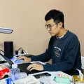
Ruichen Zhou

Satellite altimetry · Gravity models · Python & AI agents

Ruichen Zhou / 周瑞宸

PhD student in Surveying and Mapping

Turning satellite altimetry into open gravity-field products and building the Python and AI tooling behind them.

About

Current positions

PhD student in Surveying and Mapping, University of Chinese Academy of Sciences (2024–present)
Joint PhD student, University of Stuttgart (2025–present)

Research focus

  • Satellite altimetry data processing and retracking
  • Gravity anomalies and vertical gravity gradients over the oceans
  • Mean sea surface and marine gravity modelling

Recent publications

Recent publications and datasets on satellite altimetry and marine gravity:

SDUST2023VGGA: A global ocean vertical gradient of gravity anomaly model determined from multidirectional data from mean sea surface
Zhou, R., Guo, J., Ya, S., Sun, H., & Liu, X.
Earth System Science Data, 2025, 17(3), 817–836.

SDUST2023VGGA (V1.0) [Data set]
Zhou, R., Guo, J., Ya, S., Sun, H., & Liu, X.
Zenodo, 2024.

Inverting vertical gravity anomaly gradients using multidirectional data from mean sea surface model: A case of Arabian Sea
Zhou, R., Liu, X., Guo, J., Hwang, C., Jia, Y., Chang, X., & Sun, H.
Earth, Planets and Space, 2024, 76(1), Article 153.

On performance of vertical gravity gradient determined from CryoSat-2 altimeter data over Arabian Sea
Zhou, R., Liu, X., Li, Z., Sun, Y., Yuan, J., Guo, J., & Ardalan, A. A.
Geophysical Journal International, 2023, 234(2), 1519–1529.

View all publications →

Projects

Marine gravity & vertical gradient inversion

Developing and applying methods to invert gravity anomalies and vertical gravity gradients from satellite altimetry and mean sea surface data, including:

  • using grid-based MSS models to derive global vertical gravity gradient fields
  • evaluating vertical gravity gradients from along-track CryoSat-2 data over regional seas

Outputs: ESSD 2025 paper · SDUST2023VGGA dataset on Zenodo

These methods support several gravity and seabed topography modelling efforts in my group.


Altimetry waveform reprocessing

Developed scripts for coastal satellite altimetry waveform reprocessing (such as singular spectrum analysis) to improve data quality for gravity-related applications.


Student research projects

Led graduate research projects on:

  • inversion of ocean vertical gravity gradient anomalies from mean sea surface models
  • computing vertical deflection and vertical gravity gradients from along-track sea surface heights

Engineering & open source

  • Vibe coding, shipped:
    • Notebook-Translate — VS Code extension that translates Markdown cells in Jupyter notebooks into Chinese, with streaming output, multiple provider profiles (OpenAI-compatible, Ollama, Baidu), and OS keychain credential isolation.
    • mi-health-mcp — MCP server on Cloudflare Workers that exposes Xiaomi health data (sleep, heart rate, steps) to LLM agents; part of my self-hosted monitoring pipeline.
    • Alert-triage agent — an AI agent that triages server alerts: it connects to the affected host over SSH, checks services, load, and login logs, and reports its conclusion to Telegram. Write-up
  • Self-hosted overlay network — Headscale control plane and DERP relay running on a personal VPS, connecting 10+ devices across two countries; setup and evolution documented in the networking posts.
  • trellis-for-research — Trellis spec templates and a research workflow for reproducible computational research: a general research-core spec plus a geoscience deep-learning variant, with task modes (exploratory, documentation, durable) that scale checking effort to the work.
  • RAG & local LLMs — retrieval-augmented generation over research literature, running on local models via Ollama.

Curriculum vitae

For a full list of education, publications and experience, please see my CV. The CV page is password-protected; email me for access.

View CV →